Naming Wagner IX.i
Wagner IX.i – what the hell is this? Never heard of it before…
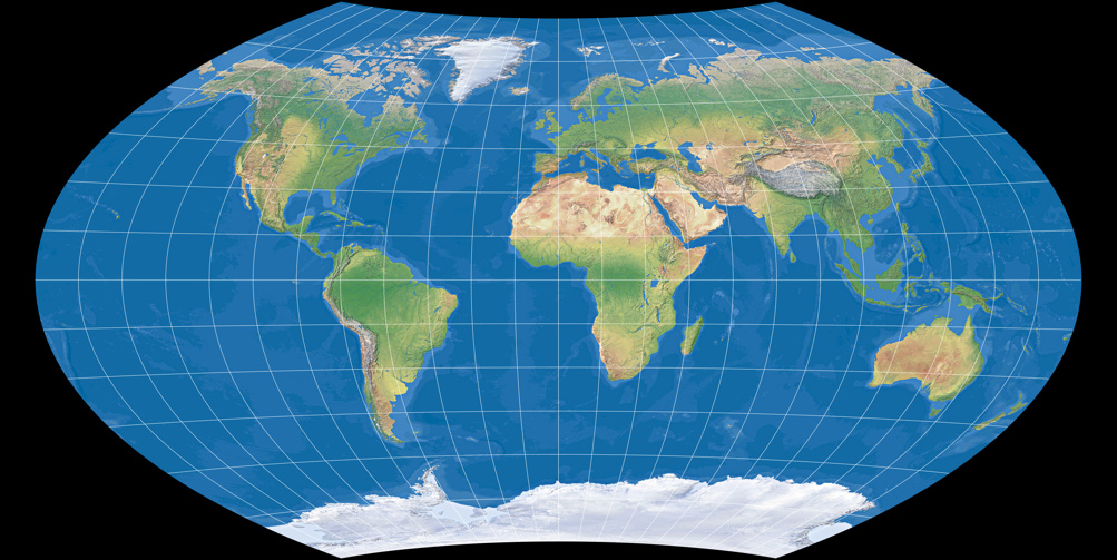
If you thought something like this when you saw the Wagner IX.i here on this site:
You’re right!
Maybe you have seen this projection before, but you surely have never read the name.
Until the end of July 2016, the projection was called Wagner Y5 here on map-projections.net. In this article, I will cover why I renamed it and under which name you might have seen the projection.
When Wagner introduced the Aitoff projection with a pole line in 1949 – nowadays, the projection is usually
referred to as Aitoff-Wagner oder Wagner IX –, he listed the formula that is needed to construct the projection and showed
a coordinate table resulting from this formula. And then he noted that you might want to add a horizontal
compression to achieve »a better distribution of distortions« by multiplying the x-values with a factor a < 1.
After that, he’s showing an illustration in which the compression has been applied,
»namely a = 0.88 was chosen. This factor was determined to approximate the shape of Winkel’s projection as close
as possible.«
[1]
(Of course, he referred to the Winkel Tripel projection.)
So basically, he introduced two variants of the projection that was later named Wagner IX:
- The projection strictly generated by the formula,
- the horizontally compressed projection according to the illustration.
This can be confusing in reading cartographic literature and using map projection software: Snyder [2] doesn’t mention the compression at all but shows the same (compressed) illustration that Wagner had, Canters [3] is referring to the compressed variant only, while progonos.com and the Anderson List are showing the projection according to the formula, just like the applications Geocart and G.Projector.
Dr Böhm pointed out this confusion and labelled the projection according to Wagner’s illustration on his (german) website as Wagner Y5, while for the variant following the formula he kept the established name Wagner IX.
When I launched this website, I adopted Böhm’s naming. However, I wasn’t quite comfortable with the name Y5 because this name in my opinion implies a different projection while actually it’s an variant.
And so I came up with the idea to call the variant according to Wagner’s illustration Wagner IX.i.
This name clearly shows that the projection is related to Wagner IX.
But why .i?
Well, maybe i as in illustration.
Maybe like the lowercase roman numeral I (= 1).
So whether you like to voice the name as »Wagner nine dot one« or rather as »Wagner nine dot eye« –
that’s completely up to you.
Just remember, the name Wagner IX.i is neither »official« nor established.
If you use it when you’re talking top cartographers or map enthusiasts, they will not know what you are talking about
(unless they have visited this website which they probably haven’t). However if somebody likes to adopt that name –
feel free to do it!
And in order to avoid further confusion – here are the two variants with their names as used on this website:
Wagner IX (strictly according to Wagner’s formula)
Wagner IX.i (according to Wagner’s illustration)

Comments
Be the first one to write a comment!
Sorry, it’s currently not allowed to add new comments.
It’ll be possible again soon.
(Well, I hope at the end of May 2024 at the latest…)