License information for Topographic World Map (Patterson)
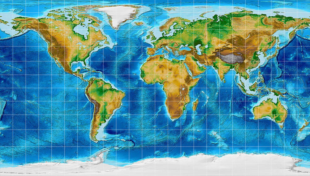
| Description | Topographic world map, projected to Patterson Cylindrical Projection. | |||
|---|---|---|---|---|
| Size(s) | 1003 × 572 | (619.24 KB, image/jpeg) | Show (new window) | |
| 400 × 228 | (192.22 KB, image/png) | Show (new window) | ||
| License |
 Topographic world map (Patterson) by Tobias Jung is licensed under a Creative Commons Attribution-ShareAlike 4.0 International License. Original image: ETOPO1 Global Relief Model Amante, C. and B.W. Eakins, 2009. ETOPO1 1 Arc-Minute Global Relief Model: Procedures, Data Sources and Analysis. NOAA Technical Memorandum NESDIS NGDC-24. National Geophysical Data Center, NOAA. doi:10.7289/V5C8276M [access date: 2014/12/27]. Changes: Colors changed; projected to Patterson Cylindrical. |
|||
Use this file in own projects
Downloading and using the image is allowed within the scope of the above-mentioned licence.
Please use the build-in functions of your web browser to download the image above.
To share the image, use the
single view.
The nifty little download function that used to be here (to download the image with a single click and to prevent file name conflicts with other images of the same projection) was removed due to heavy traffic caused by bulk downloads. Sorry!
Use this file on the web
Please respect the terms as stated in the CC BY-SA 4.0 License.
Whenever possible, please download the image to install it on your own website rather than using the
File URL given above to embed it.
Figures in Articles
- World map using a flawed rendition of the Patterson Cylindrical Projection (Ocean with layered depth tints)
- World map using Patterson Cylindrical Projection (Ocean with layered depth tints)
- NPP world map, projected to Patterson Cylindrical Projection.
- Population Density 1994, projected to Patterson Cylindrical Projection.
- Political world map, projected to Patterson Cylindrical Projection.
- Political world map, projected to Patterson Cylindrical Projection.
- Political world map, projected to Patterson Cylindrical Projection.
- Topographic world map, projected to Patterson Cylindrical Projection.
- Climatic world map, projected to Patterson Cylindrical Projection.
- Time Zones of the World (October 2015), projected to Patterson Cylindrical
- Early human migrations, projected to Patterson Cylindrical Projection.
- Airline traffic world map, projected to Patterson Cylindrical Projection.
- Decorative world map, projected to Patterson Cylindrical Projection.